-
Mandatory SuDs for England!
Good news today regarding SuDS, stormwater management, storm overflows, flood risk and pollution. Mandatory SuDS are coming to England. Developers will no longer have an automatic right to connect stormwater to the sewer but will be required to have sustainable drainage systems approved from a SuDs approval body before starting any construction work that has…
-
News! Real-Time storm discharge data now available from Thames Water
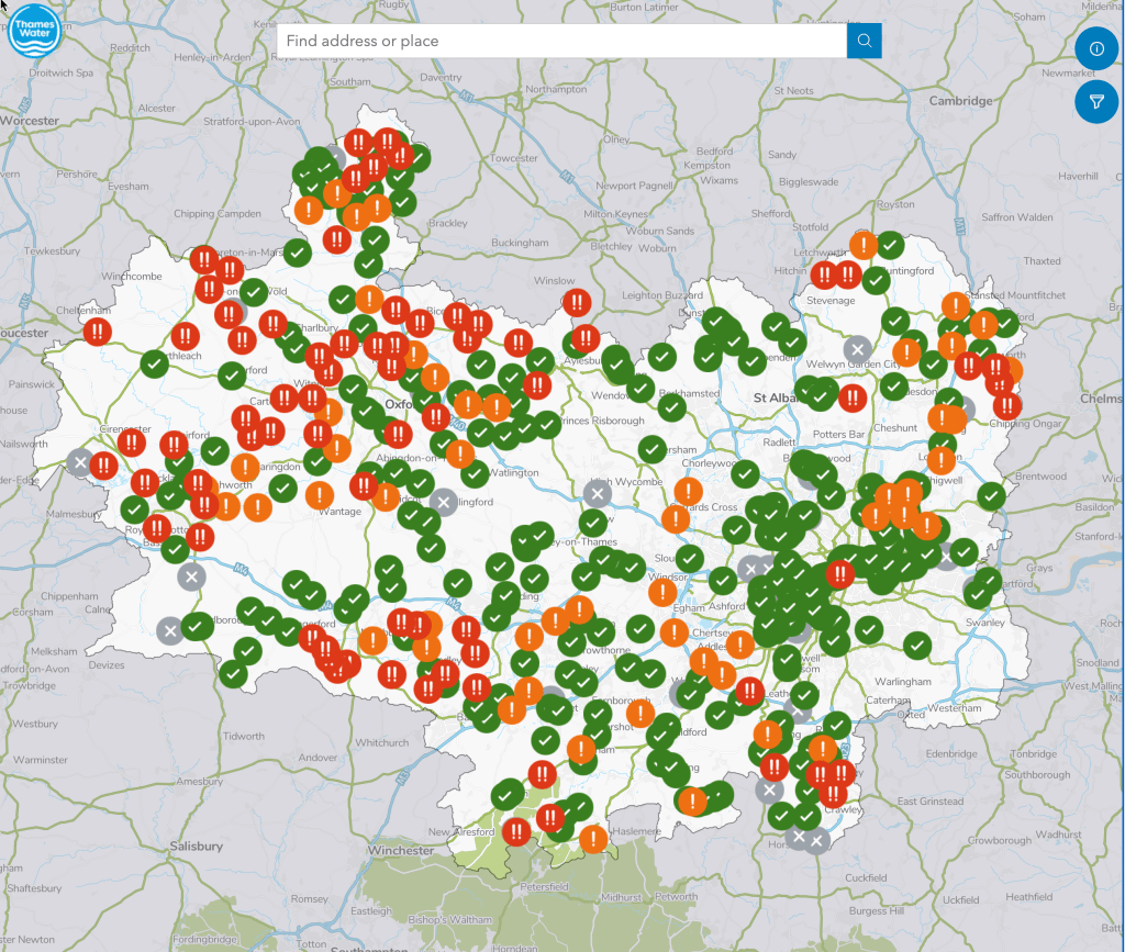
Some significant news on river pollution! Thames Water have today 4/01/2023 released a “live” map showing near real-time data on storm discharges at their sewage treatment plants. This is useful to identify how often and how long storm overflows occur. Thames Water want to be more transparent and open about their storm discharge activity. We…
-
Development threats to runoff in the Upper Mole Basin

Analysis of potential impacts on runoff and river flow of three developments in the Upper Mole basin.
-
Rainfall intensity rules River Mole runoff, to a point.
Bit of a cryptic title but this follows my previous post on how our flashy local river responds to rain. Two recent contrasting rainfall events occurred at the tail end of this wet November and it struck me how the Mole responded quite differently to these. So in this post I have drawn up hydrographs…
-
River Mole: flashy by nature?
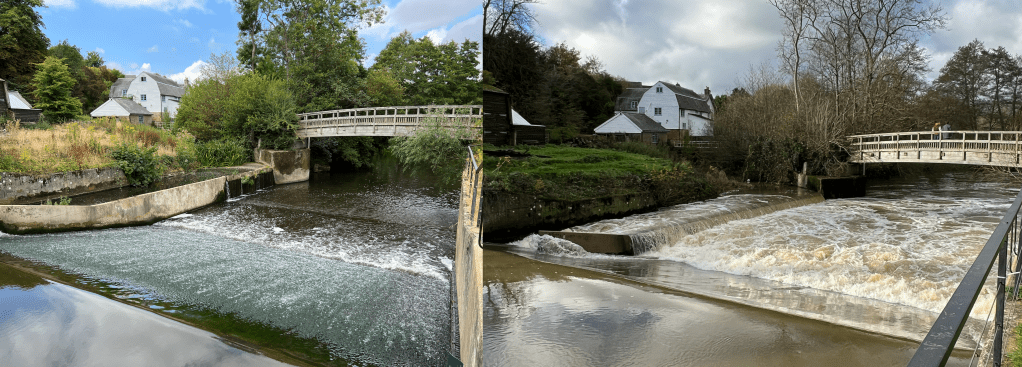
The River Mole is a flashy river! This means levels rise quickly after rain falls over the catchment. The hydrograph below shows the River Mole discharge at Gatwick gauging station rising quickly after a heavy squall line passed over the catchment, dropping 11mm in less than 1 hour. This is not outside normal rainfall but…
-
Learning about anglers on the River Mole

Anglers in active and well run angling societies such as Horley Piscatorial Society are a vital foundation for river health. It seems to me that they connect up a network of other stakeholders from farmers to councils, the EA and other charities and conservation groups.
-
A video following the Mole downstream from source to Thames!
I’ve made a video to celebrate our local river by following it downstream from source to the confluence with the Thames. It highlights the challenges our river faces and picks up some of the key places and features (obviously not all… and slightly skewed to where I know best which is the upper mole). I…
-
The 1968 Mole Flood
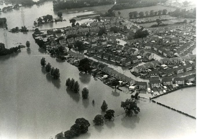
The worst recorded flooding in the River Mole was in 1968 when a rare 1:200 year storm caused rainfall to exceed 100mm in 24 hours and a staggering discharge over 240 cumecs in the Lower Mole (see extract below). For comparison, the average discharge of the River Thames in London is 65 cumecs and the average September…
-
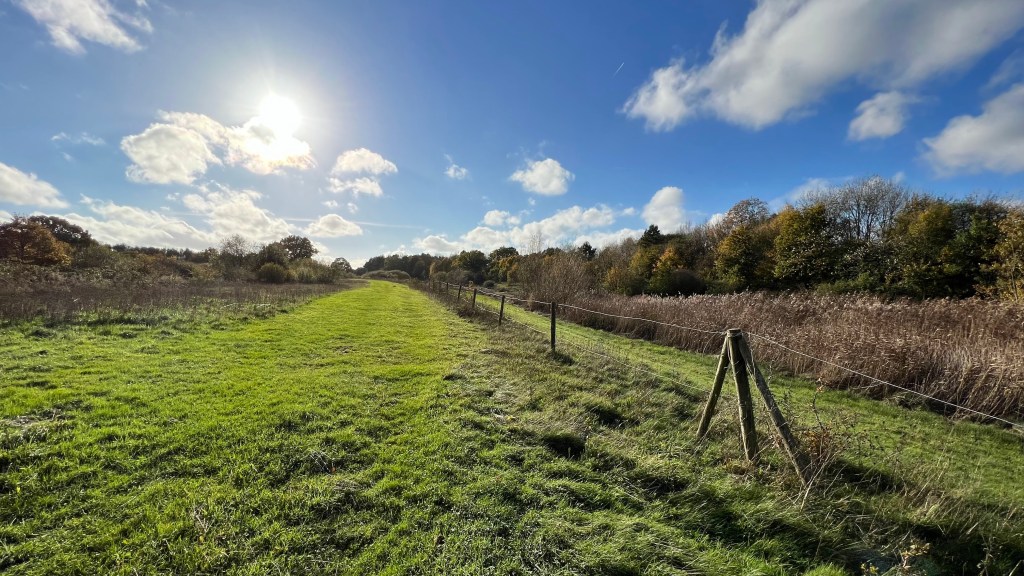
In search of the Source of the River Mole!
Sadly not some epic blockbuster but a modest 10 minute movie showing a recent (dry) walk to find the source of the Mole near Rusper. I followed the baby Mole downstream to Lambs Green through the typical rural and semi-rural countryside in this part of Surrey. The land use here is a mix of woods…
-
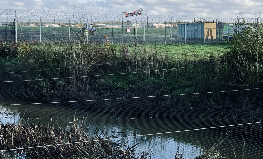
Flood-Gate? Gatwick Airport flood and water management in the Mole drainage basin

This post explores flood control engineering, water management and pollution controls currently in place at London Gatwick airport. The post adds detail to the previous article on flood control in the River Mole basin and should provide a fuller understanding of flood control on the River Mole including management of water flows through Gatwick airport and any impact…
The Mole Story
A website about the River Mole in Surrey, South East England. Associated with River Mole River Watch.
