Category: River Mole
-
River Mole: flashy by nature?
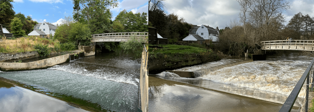
The River Mole is a flashy river! This means levels rise quickly after rain falls over the catchment. The hydrograph below shows the River Mole discharge at Gatwick gauging station rising quickly after a heavy squall line passed over the catchment, dropping 11mm in less than 1 hour. This is not outside normal rainfall but…
-
The 1968 Mole Flood
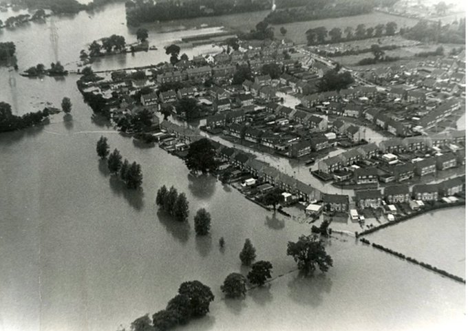
The worst recorded flooding in the River Mole was in 1968 when a rare 1:200 year storm caused rainfall to exceed 100mm in 24 hours and a staggering discharge over 240 cumecs in the Lower Mole (see extract below). For comparison, the average discharge of the River Thames in London is 65 cumecs and the average September…
-
In search of the Source of the River Mole!
Sadly not some epic blockbuster but a modest 10 minute movie showing a recent (dry) walk to find the source of the Mole near Rusper. I followed the baby Mole downstream to Lambs Green through the typical rural and semi-rural countryside in this part of Surrey. The land use here is a mix of woods…
-
Flood-Gate? Gatwick Airport flood and water management in the Mole drainage basin

This post explores flood control engineering, water management and pollution controls currently in place at London Gatwick airport. The post adds detail to the previous article on flood control in the River Mole basin and should provide a fuller understanding of flood control on the River Mole including management of water flows through Gatwick airport and any impact…
-
2013 Flooding on the River Mole: causes, impacts and management
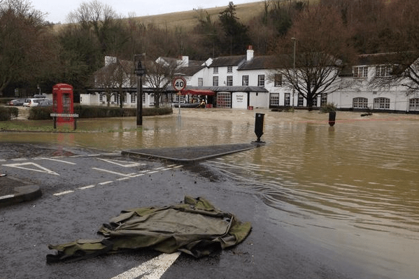
The River Mole is a modest lowland river in SE England that rises near Rusper in the wooded hilly heartland of the Surrey / Sussex Weald, near Crawley and Horsham. The Mole and its tributaries flow broadly north, through Crawley, around and under Gatwick airport, before meandering through mostly rural countryside to Dorking. The Mole…
