Category: hazards
-
Development threats to runoff in the Upper Mole Basin

Analysis of potential impacts on runoff and river flow of three developments in the Upper Mole basin.
-
The 1968 Mole Flood
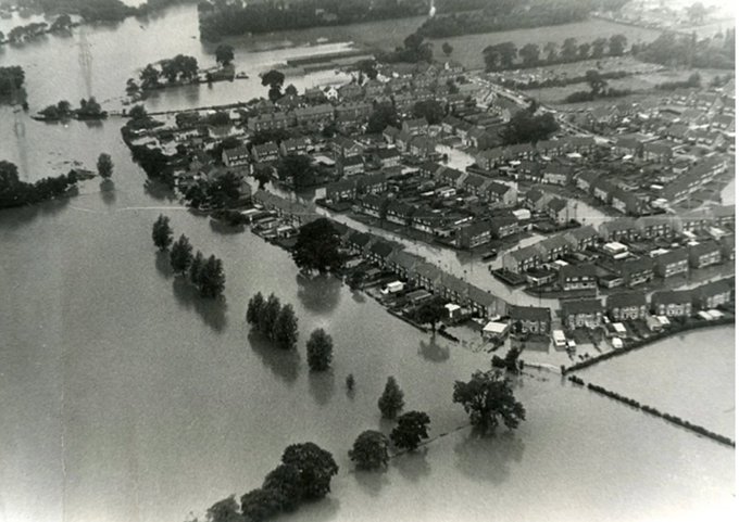
The worst recorded flooding in the River Mole was in 1968 when a rare 1:200 year storm caused rainfall to exceed 100mm in 24 hours and a staggering discharge over 240 cumecs in the Lower Mole (see extract below). For comparison, the average discharge of the River Thames in London is 65 cumecs and the average September…
-
2013 Flooding on the River Mole: causes, impacts and management
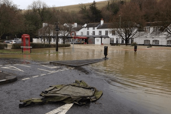
The River Mole is a modest lowland river in SE England that rises near Rusper in the wooded hilly heartland of the Surrey / Sussex Weald, near Crawley and Horsham. The Mole and its tributaries flow broadly north, through Crawley, around and under Gatwick airport, before meandering through mostly rural countryside to Dorking. The Mole…
